28 May 2024
In early April, the Bay of Plenty Regional Council’s (BOPRC) Land Management team journeyed to Gisborne to see the issues that the Gisborne District Council Land Management team are currently facing in the region. They were also joined by some of the Hawke’s Bay Regional Council's (HBRC) Land Management team.
The two-day trip provided the opportunity for staff to get together to discuss the different land management issues being faced by the neighbouring regions and the ways in which these issues were being addressed.
Throughout the two days ongoing commentary was given by GDC’s Senior Land Management staff, with additions from members of the visiting teams, discussing the challenges faced by different pieces of land in the district, the geological makeup of areas and other relevant factors that have contributed to the issues being faced today.
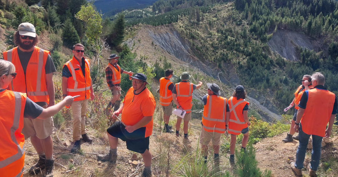
The field trip began in Otoko where the GDC team presented to BOPRC some of the issues we are working with. Large sections of the hills in the area have been subjected to slipping, which was intensified by cyclones Hale and Gabrielle.
This stop introduced the BOPRC team to a very common problem on many farms in our region where relatively steep agricultural land has become vulnerable to the effects of severe weather events. The question that was asked is what the best ways are to prevent further erosion considering the limited resources available to landowners and councils.
Next stop was Whatatutu to look at how effective extensive tree planting has been on earthflow erosion at Rangatira Station. Further on up the Whatatutu Road, the BOP team were introduced to the world famous Tarndale and Mangatu slips. Given the speed and severity of the erosion here, it was unsurprising that the tracks to the slips had changed since the GDC team last went up in December.
Because of the severity of the slips today, the discussion focused on how the effects of the sediment discharge downstream can be mitigated to prevent excessive damage to houses and farmland across the Poverty Bay flats. Normally the focus would also be on preventing the erosion at the source, however the Mangatu and Tarndale slips have reached a point where this is no longer realistic, placing a stronger focus on reducing the effects rather than prevention. The day concluded in Whataupoko, with a discussion on how houses and people in the urban environment are affected when hillsides give way.
On day two, the teams headed to Waerenga-O-Kuri where the HBRC team met us at the community hall and each group gave presentations on the various work programmes being undertaken in the different regions.
Topics covered included how the different regions are managed, what the priorities are and how work streams are funded, what environmental monitoring is being undertaken by the various councils and how the data is captured and used. This was followed by a tour of the Council managed Waerenga-O-Kuri poplar and willow pole nursery where nursery manager Allan Hughes, despite recently breaking his leg, provided an in-depth rundown of the nursery and the uses of the different poplar and willow varieties. To wrap it up we were once again introduced to a case of severe gully erosion located behind the nursery.
Fostering relationships with our Land Management counterparts in neighbouring regions is important. The sustainable management of our regional boundaries requires a collaborative approach, and the effects of land management decisions made in certain catchments such as the Hangaroa and Motu can be felt beyond our region.
We are also fortunate to be able to benefit from some of the work programmes and research being undertaken by BOPRC and HBRC through their access to funding and the sharing of information and resources.