1 June 2023
AgResearch has sourced funding to undertake silt sampling in Hawke’s Bay and Tairāwhiti. The objective of this project is to undertake a rapid assessment of flood affected productive land impacted by long saturation and sediment deposition in Hawke’s Bay, Tairāwhiti and Northland.
It was recognised that there was an urgent need to establish ground cover to start to repair and restore land as soon as possible and provide guidance to landowners on remediation, land preparation and nutrient management.
Council Land Management staff have been involved in undertaking the sampling work over the last few weeks. The nature and depth of sediment have been assessed by catchment and proximity to river source points. Sediment and soil samples were obtained along with information on the actions land managers have taken or are proposing to take. Suggestions have also been made to land managers around remedial options.
In total 55 samples of sediment and soil were collected from thirty-nine locations throughout the region including the Waiapu, Uawa and Waipaoa catchments.
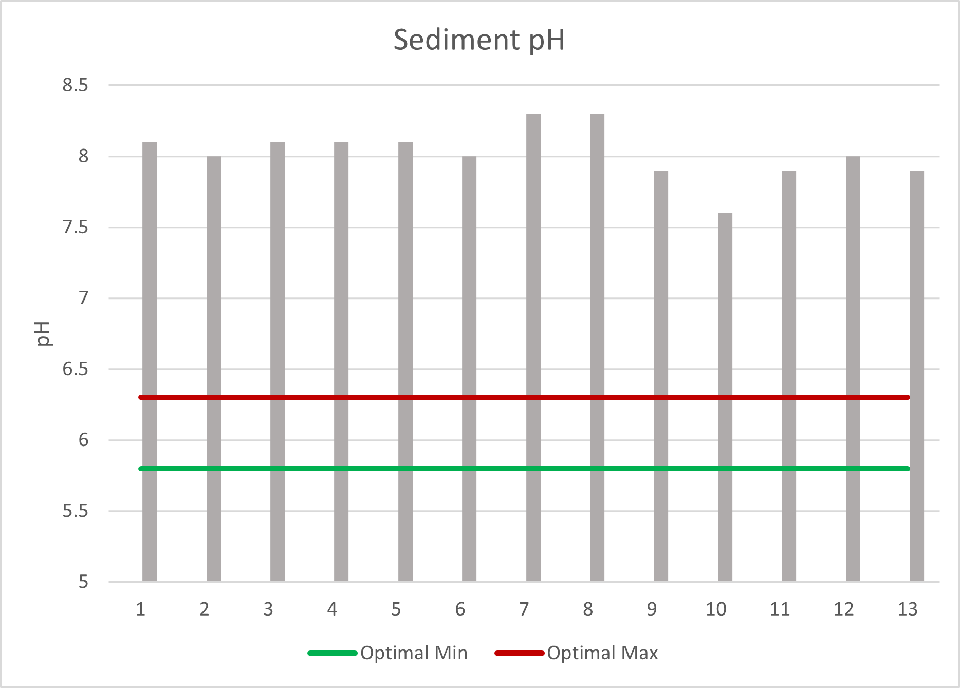
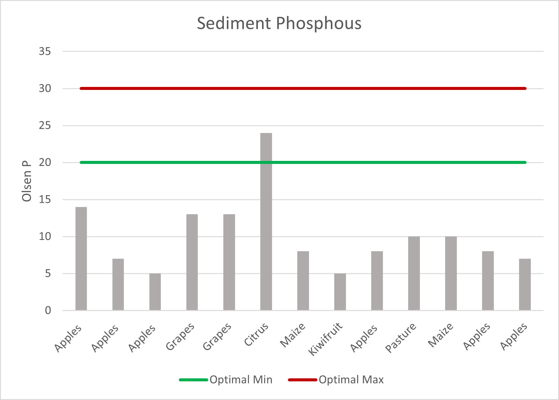
The results are still to be fully analysed, but early indicators are that the sediment has a high pH and sulphur and low Olsen P compared to the underlying soil.
The next steps are to collate and analyse the results once received, interpret the findings and look for opportunities to build resilience.
The data collected will provide baseline information for assessing and reviewing the effectiveness of various management strategies applied, in addition to the data from the 1948 Gisborne floods and the 2004 southern North Island storm. Most of the data from 2004 comes from pastoral systems so it will be particularly useful to learn about the cropping and horticulture land use types this time around.
The data will also provide land managers with real time information and will provide sectors with better intelligence on the most effective action to take following future events.
Interim results of note from 13 of 39 locations
pH is very high

Phosphorus is low

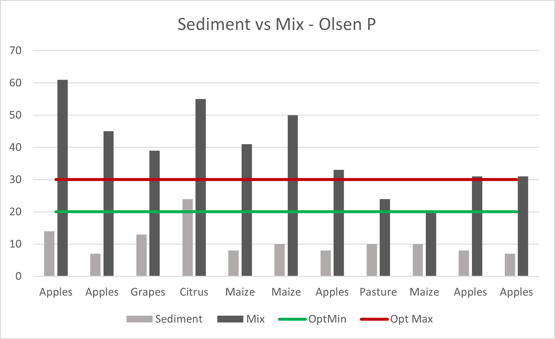
Mixing shallower sediment with old topsoil brings soil nutrient status up significantly

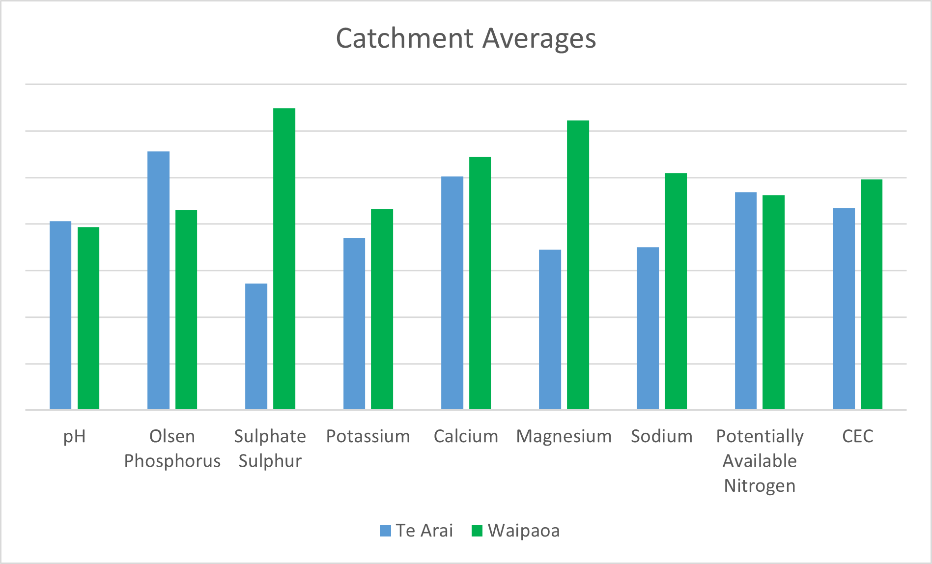
There are some differences in chemical composition between catchments

