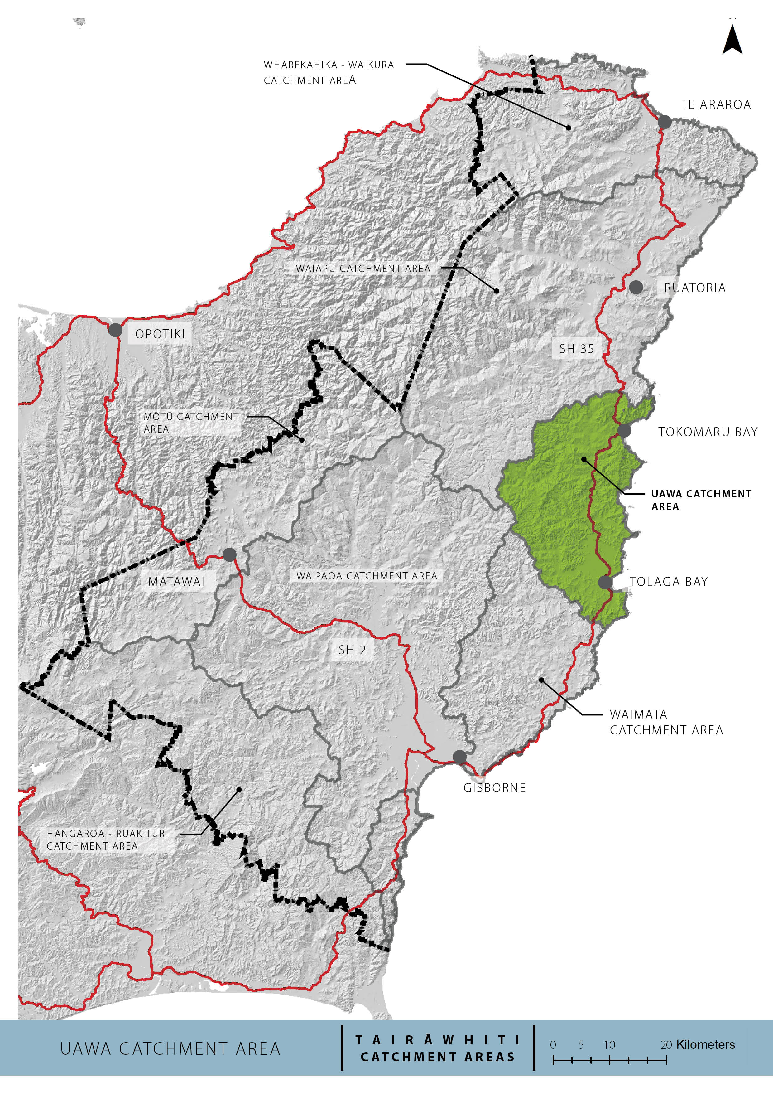
The Ūawa combined catchment area has a land area of 668km2 and is located north of Gisborne. Key rivers in this catchment include the Ūawa, Hikuwai, Mangahauini and Mangaheia. Hikuwai is known for high flows in flood situations where the water level can quickly rise by more than 10m. River flow, rainfall and a range of water quality parameters are measured at Willow Flat and Hikuwai Bridge sites on the Hikuwai river.
The townships in this area are Tolaga Bay, Anaura Bay, and Tokomaru Bay. Flat land near Tolaga Bay has been developed for a range of crop types. Irrigation is piped hundreds of metres to avoid the salt water in the Ūawa. Other land uses include extensive sheep and cattle farming, and significant areas have been changed into exotic forestry since the 1980s.
Near the turn of the 20th century, widespread deforestation resulted in substantial erosion and gully slipping that peaked in the 1970s prior to major reforestation programmes. The catchment was further affected by the devastation caused by Cyclone Bola, leading to most of the worst eroding land planted in exotic forestry. Since harvest began, land sliding and debris flow have been frequent and worsened by more severe weather events.
Plan Stop legislation may affect the timeline
The government’s Plan Stop legislation came into effect on 21 August 2025. This means that until 31 December 2027, councils can’t notify new plan changes or reviews unless they have an exemption.
This may affect the timeline and scope of the catchment plans.
Sedimentation issues in the catchment
Our region carries an erosion risk on a scale and severity greater than any other part of New Zealand. A lot of unstable land has been used for soil conservation. Since 2010, harvesting on this land has accelerated, and the region has also been hit with greater and more frequent severe weather events.
As first rotation harvests on steep lands have proceeded, sediment and woody debris have been deposited into waterways, onto floodplains and beaches and ultimately the coastal environment. Removing all the trees from steep slopes next to waterways increases the risk of sediment generation and its detrimental effect on the river.
The proposed plan change aim to address this issue.
Forestry and the Ūawa Catchment Plan
Forestry management and catchment planning are closely intertwined due to the significant impact that forest management practices have on our waterways.
The Ūawa combined catchment area is heavily forested. Since harvesting began, land sliding and debris flow have been frequent and worsened by more severe weather events.
Proposed plan changes
We’re working on a plan change that aims to strengthen how highly eroding and erosion-prone land is managed. The goal is to reduce the amount of sediment and woody debris entering waterways and to support the long-term transition of vulnerable land to more sustainable land uses.
We’ll provide further updates as the plan change progresses.
Council will develop a Freshwater Catchment Plan for the Ūawa catchment as part of its implementation of the National Policy Statement for Freshwater Management 2020.
A Freshwater Catchment Plan is a tool that focuses on managing freshwater and land uses at a catchment scale. They provide a way to:
- identify and understand the freshwater values relevant to the catchment area
- set a vision for how we want to see the catchment area in the future
- outline the requirements and actions needed for achieving that vision
The Ūawa Catchment Plan will provide a pathway for managing freshwater quality and quantity. This pathway will be set in conjunction with tangata whenua, stakeholders and the community and will help Council make better decisions about land and water use within this area.
Ūawa Catchment Working Group
We've established an Ūawa Catchment Working Group to inform the development of the Catchment Forestry Plan and the Freshwater Catchment Plan.
The purpose of the Ūawa Catchment Working Group is to bring together the knowledge and local expertise of the people who know the catchment area best.
A total of 12 members were sought for the group. Mana whenua (Ngāti Porou and Te Aitanga a Hauiti) have nominated their representatives onto the Working Group. Interested parties have submitted their Expression of Interest via the application form.
Mana whenua can elect to participate in the plan development outside of the evaluation process.
A chair has been appointed by Council and Hauiti Mana Kaitieki Collective for this Working Group.
We’ve wrapped up all the scheduled hui that started in July 2024.
Evaluation of applications - Application period closed
We have evaluated applications to decide suitability of applicants and to ensure a suitable size of membership. Criteria for evaluating applications were:
- Demonstrated strong link to Tairāwhiti region and/or the Ūawa Catchment
- Have experience in forestry and interest in freshwater
- Demonstrated ability to work with others and collaborate.
The development of the Catchment Forestry Plan and the Freshwater Catchment Plan will be guided by the Advisory Group consisting of 12 members. Group members have committed to regularly attending monthly meetings to help in the development of these plans.
Members have strong connections to the Tairāwhiti region and/or the Ūawa Catchment, experience in forestry, an interest in freshwater, and represent a range of community perspectives. The advisory group members are:
- Victor Walker
- Kel Blackman
- Richard Powell
- Andre Van Haandel
- Shaun Mitchel
- Tim Jefferd
- Phil Hope
- Mere Tamanui
- Desmond McGrannachan
- Tiahn Hopper
- Horiata Raihania
- Karauria Ratapu
Advisory Group documents
- No reports for hui 1 & 2
- Hui 3 Report 1- 20 August - FMUs
- Hui 3 Report 2 - 20 August - Environmental
- Hui 4 Report - 18 September - State of the environment
- Hui 4 Report - 18 September - Supplementary report, baselines
- Hui 4 Report - 18 September - Visions, Values and FMUs
- Hui 5 Report - 15 October - Action Planning
- Hui 5 Report - 15 October - Outstanding and Scheduled Waterbodies
- Hui 5 Report - 15 October - State of Environment, Baseline, and Target Attribute States
- Hui 6 Report - 12 November - Transition Advisory Group
- Hui 7 Report - 11 December - Draft Actions for Action Plan
- Hui 7 Report - 11 December - NES FW and the Ūawa Catchment
- Hui 7 Report - 11 December - Updated Vision, Values, Environmental Outcomes and Attributes
- Hui 7 Report - 11 December - Water Quantity Issues in the Ūawa Catchment
How to get involved
- Check for any open engagements - kōrero mai via our engagement portal
- Ask us a question - email the team service@gdc.govt.nz
- Sign up for Council News | He Pānui - using this form.