13 January 2025
Council is progressing wetlands mapping in Te Tairāwhiti, which is required by the National Policy Statement for Freshwater Management 2020.
A fixed-wing aircraft will be flying low over the region from January through to April 2025 when weather conditions are favourable.
The plane is capturing oblique imagery, which is taken at a 45 degree angle to the ground to improve our understanding of wetlands in our region.
We will also use the imagery for improving our Te Karaka Flood Control Scheme and Waipaoa River Flood Control Scheme.
The first area to be flown will be from Te Karaka down the Waipaoa River to the coast. Flights will then move on to the Waimatā - Pakarae catchment before covering the remainder of the region.
See below for flight details:
| Date | Detail |
|---|---|
| 14, 15, 16 March 2025 | See the image below for planned operations. 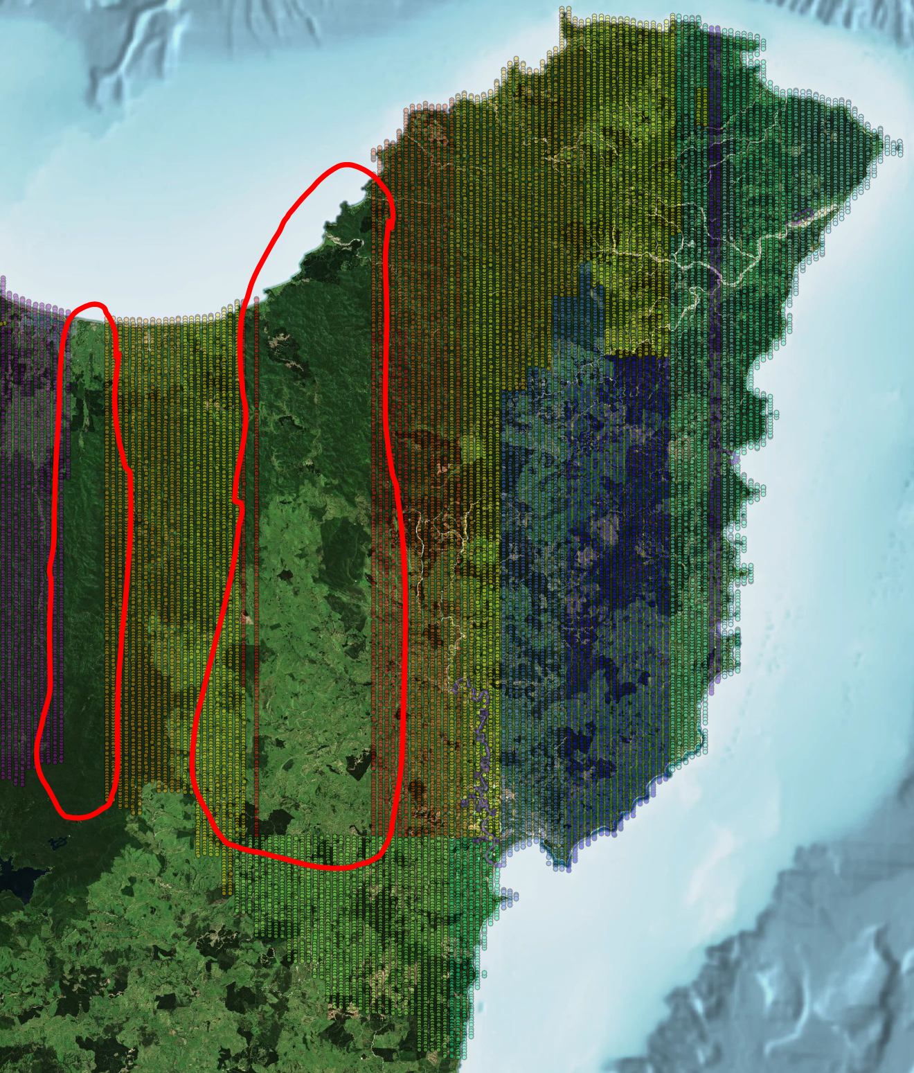 |
| 2 -3 March 2025 | See the image below for planned operations.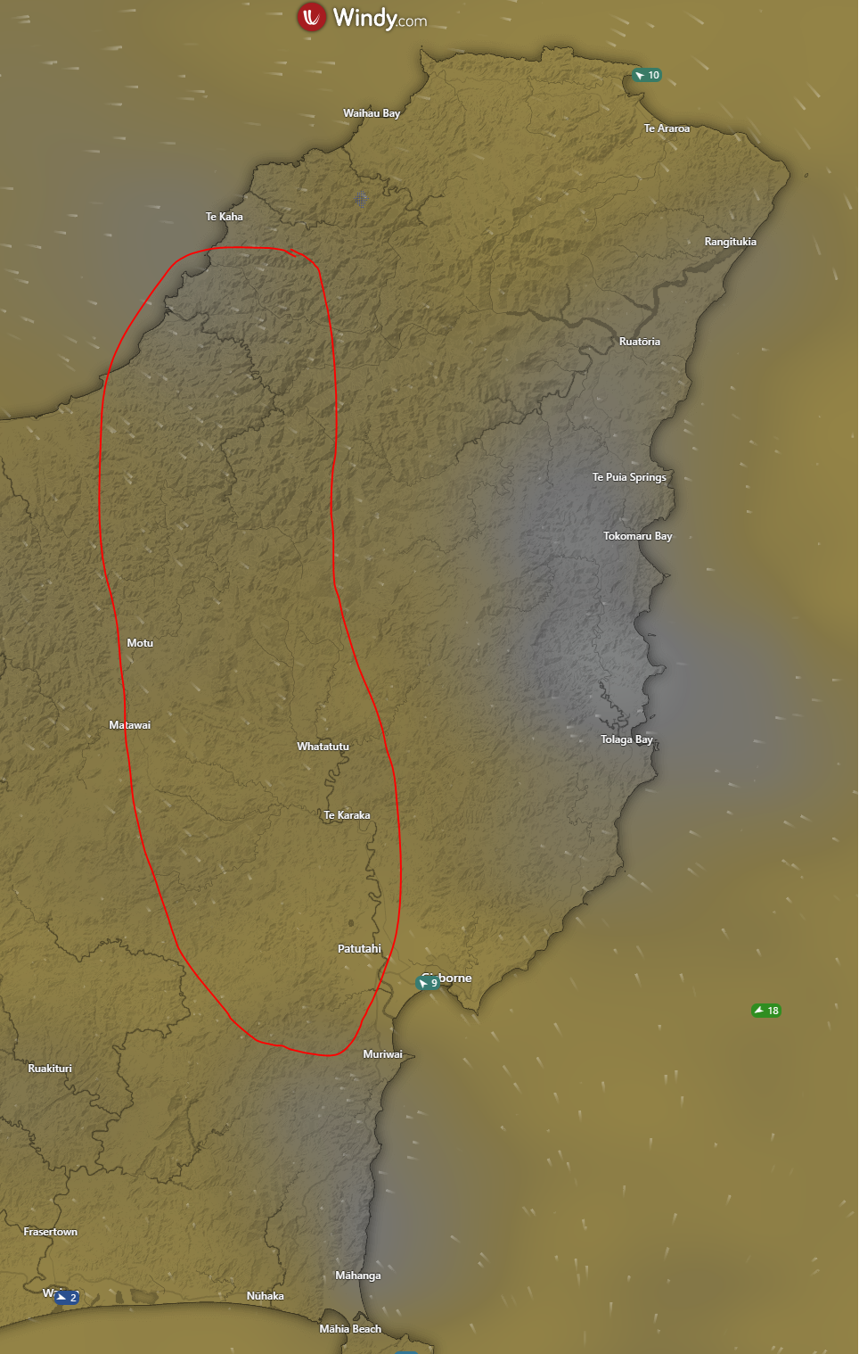 |
| 26 February 2025 | Western side of the region |
| 21 - 23 February 2025 | See the image below for the planned operations. The priority area is the central high part of the region, as shown in the encircled section.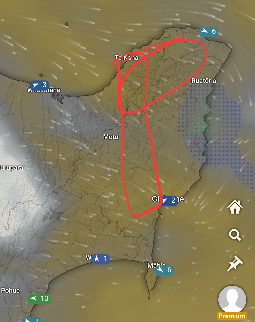 |
| 10 February 2025 | Mt Hikurangi area |
| 7 - 12 February 2025 | See the image below for the planned operations. The red area represents the first priority, with the yellow area as backup if weather conditions require adjustments.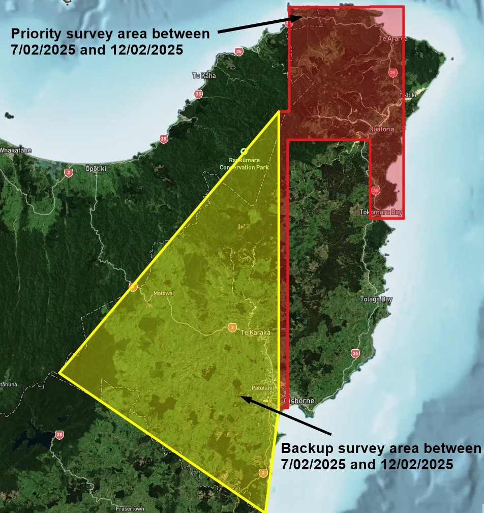 |
| 30 - 31 January 2025 | Gisborne City to the Ruakumara Ranges and surrounds |
| 29 January - 2 February 2025 | Working east to west from East Cape to Gisborne |
| 28 January 2025 | River stop bank surveys. Waipaoa River from Te Karaka to the coast, Tokomaru bay township, Tikitiki Township |
For more information